


New Church Voting District, Accomack County, Virginia
About
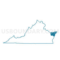
Outline

Summary
| Unique Area Identifier | 680975 |
| Name | New Church Voting District |
| County | Accomack County |
| State | Virginia |
| Area (square miles) | 30.82 |
| Land Area (square miles) | 30.49 |
| Water Area (square miles) | 0.33 |
| % of Land Area | 98.94 |
| % of Water Area | 1.06 |
| Latitude of the Internal Point | 37.97515280 |
| Longtitude of the Internal Point | -75.53560260 |
Maps


Graphs
Select a template below for downloading or customizing gragh for New Church Voting District, Accomack County, Virginia


Neighbors
Neighoring Voting District (by Name) Neighboring Voting District on the Map
- Atlantic Voting District, Accomack County, VA
- Greenbackville Voting District, Accomack County, VA
- Oak Hall Voting District, Accomack County, VA
- Voting Districts not defined, Somerset County, MD
- Worcester Precinct 01-001, Worcester County, MD
- Worcester Precinct 01-002, Worcester County, MD
Top 10 Neighboring County Subdivision (by Population) Neighboring County Subdivision on the Map
- District 1, Southern, Worcester County, MD (6,686)
- District 2, Accomack County, VA (4,763)
- District 3, Accomack County, VA (3,605)
- District 3, Brinkleys, Somerset County, MD (1,491)
Top 10 Neighboring Place (by Population) Neighboring Place on the Map
Top 10 Neighboring Unified School District (by Population) Neighboring Unified School District on the Map
- Worcester County Public Schools, MD (51,454)
- Accomack County Public Schools, VA (33,164)
- Somerset County Public Schools, MD (26,470)
Top 10 Neighboring State Legislative District Lower Chamber (by Population) Neighboring State Legislative District Lower Chamber on the Map
- State Legislative Subdistrict 38B, MD (88,842)
- State House District 100, VA (52,095)
- State Legislative Subdistrict 38A, MD (45,791)
- State House Districts not defined (Somerset County), MD (0)
Top 10 Neighboring State Legislative District Upper Chamber (by Population) Neighboring State Legislative District Upper Chamber on the Map
- State Senate District 6, VA (152,346)
- State Senate District 38, MD (134,633)
- State Senate Districts not defined (Somerset County), MD (0)
Top 10 Neighboring 111th Congressional District (by Population) Neighboring 111th Congressional District on the Map
Top 10 Neighboring Census Tract (by Population) Neighboring Census Tract on the Map
- Census Tract 902, Accomack County, VA (6,156)
- Census Tract 9515, Worcester County, MD (4,951)
- Census Tract 9305, Somerset County, MD (4,396)
- Census Tract 9514, Worcester County, MD (3,355)
- Census Tract 903, Accomack County, VA (2,335)
Top 10 Neighboring 5-Digit ZIP Code Tabulation Area (by Population) Neighboring 5-Digit ZIP Code Tabulation Area on the Map
- 21851, MD (7,315)
- 23415, VA (1,893)
- 21838, MD (1,736)
- 23395, VA (645)
- 21864, MD (611)
- 23416, VA (356)
- 23488, VA (201)